|
|
|
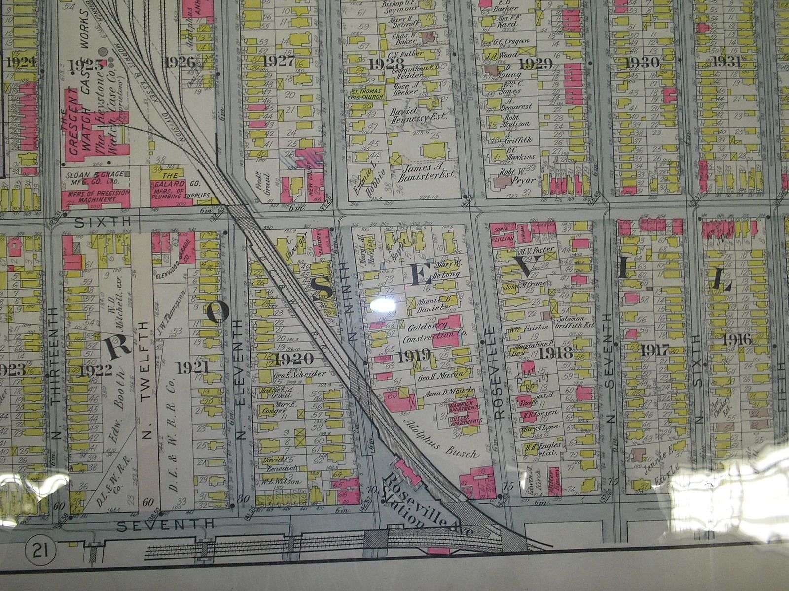
This is actually an image from the 1911 edition showing Sixth Avenue between N. 13th and N. 6th streets. Back to 1901
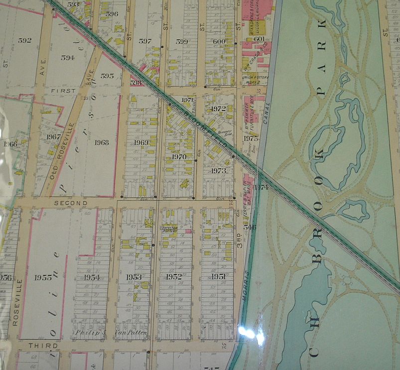
for this look at the Old Roseville Avenue that veered off at Second Avenue.
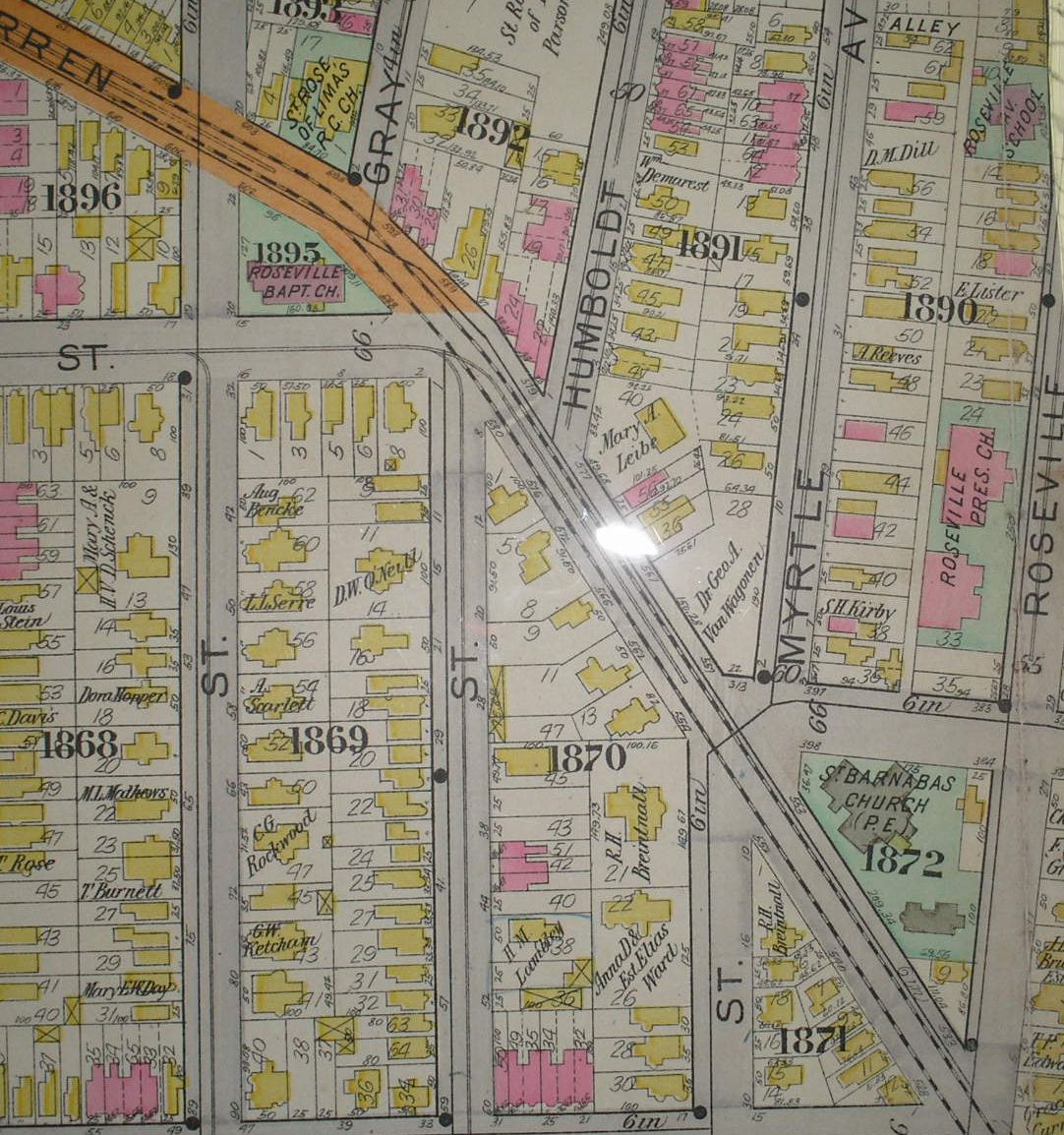
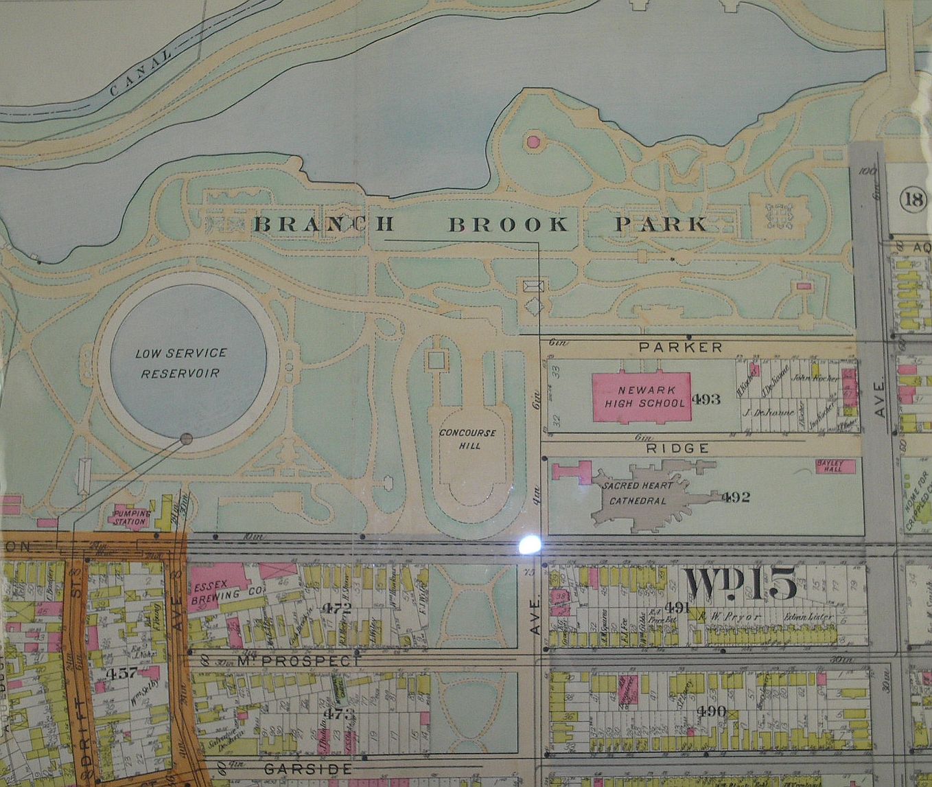
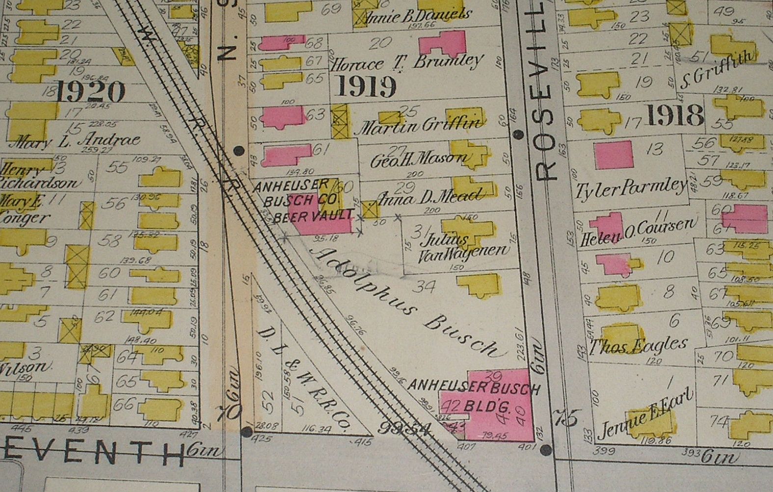
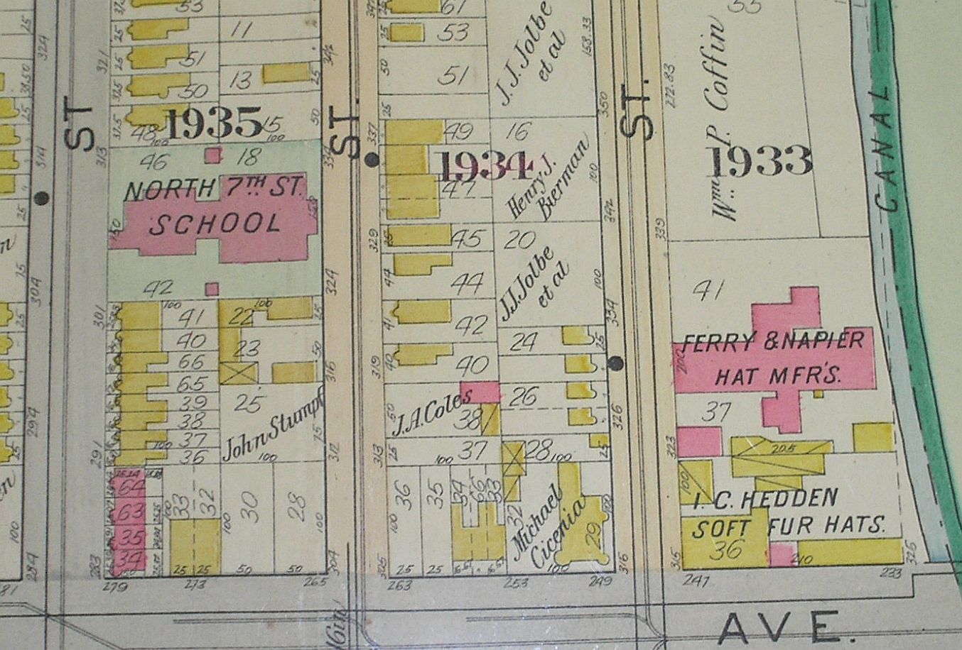
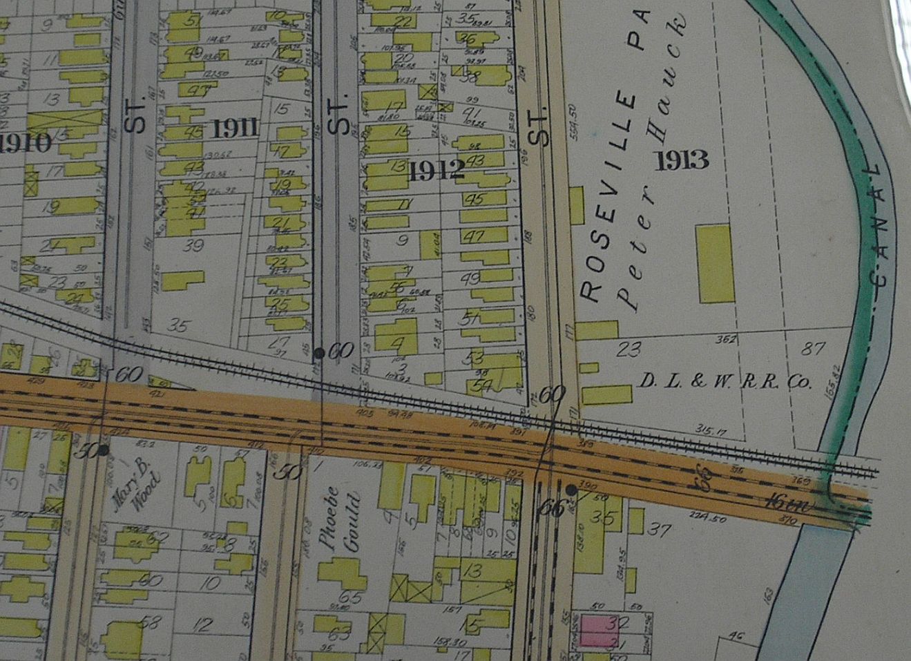
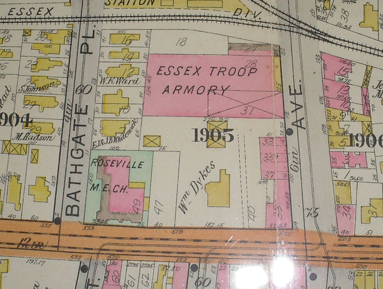
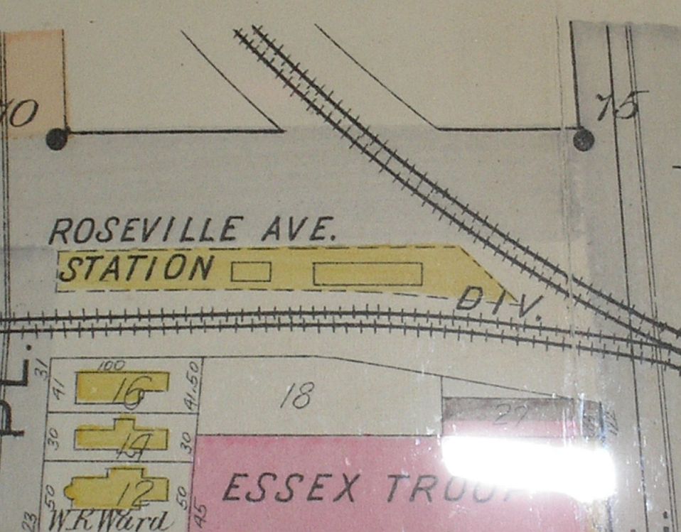
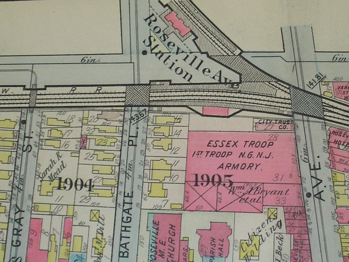
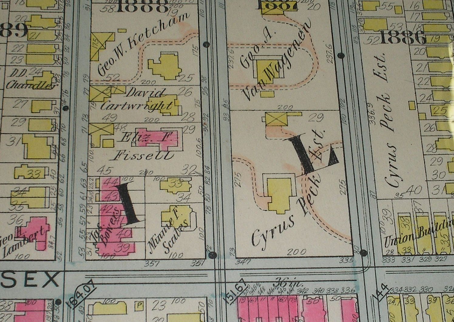
Warren - Humboldt neighborhood Shows Warren Street (later named W. Market Street) where it meets Humboldt Street. Note the old St. Rose of Lima Church (formerly Roseville Methodist Church) on Gray Street, on the site of the present SRL playground. The old rectory was up on the corner of Orange and was torn down to build the school. The north is to the right in this depiction of the reservoir (later the skating rink), Newark High School (later Barringer), and the Cathedral of the Sacred Heart. Also shows a bit of the old First Ward. Beer baron Adolphus Busch was quite the central figure in Roseville. He owned a nice chunk of property on Roseville and Seventh avenues tha stretched over to N. 9th Street, where he built his "Beer Vault." The corner building would later house Foster's Drug Store. And there's a relatively modest structure where the McAvoy would later rise. Where old Fifth Avenue (later Park Avenue) met the Morris Canal (later the City Subway) there were no fewer than two hat companies, one of them on the site later occupied by a hamburger joint called the White Circle or the White Rose or the White something. Also shown is the No. 7th Street School, later Garfield, between 6th and 7th streets. Later the site of Newark Academy, Roseville Park stretched between First Street and the canal. It shows Peter Hauck as the owner, who used to hold beer fests there. Ah, for the good old days! Displays the block bordered by Bathgate Place, Roseville Avenue, Orange Street and Seventh Avenue, including the Essex Troop Armory, the Roseville Methodist Episcopal Church, the estate of Wm. Dykes (later site of Bodholt's Diner!), and in the very lower left-hand corner the old St. Rose rectory. (The rectory was originally built as the SRL church but converted after the Methodists sold the parish its old church on Gray and Warren streets. That building would also serve as the first SRL school before being torn down to build the present school.) Back in 1901 the Delaware, Lackawanna and Western line was still at street level, and the Roseville Station was built next to it along Seventh Avenue. By 1911 the railroad tracks had been lowered below grade (the "Roseville Cut"), and the station moved to the northeast corner of Seventh Avenue and N. 9th Street. Easily the most distinctive house in Roseville was the Peck Estate, on Sussex between Fifth and Sixth streets. Cyrus Peck (1829-1907) built the estate, which later served as headquarters of the Roseville Improvement Company and the estate of Peck's father Aaron, president of the Sussex Railroad (later a branch of the DL&W). Cyrus Peck, besides his roles as executive of the Continental Insurance Company for 40 years and president of the City Trust Company of Newark, was an elder of the Roseville Presbyterian Church, and after his death the magnificent house became a retirement home for ministers. The Pecks donated the property across Fifth Street for the Roseville Branch of the NPL. The family also donated a large tract of land that comprised the middle section of Branch Brook Park; it had been active in establishing in 1894 the Essex County Park Commission, the nation's first such organization. Peck served as its first president.
|